AERIS OVERWATCH SYSTEMS · Engineering Walkthrough & LinkedIn Showcase
ORGSONAR → 1ST-PLACE EVERBRIDGE FREAKY FRIDAY → 1909 VERMONTVILLE INSPIRATION → AI + MAVIC 2 PRO

From Fictitious Enterprise to Live In-Flight Software: Progressive Focus Dissolve

To demonstrate OrgSonar (pairing formal compliance milestones with continuous, day-to-day operational health signals across teams), I wanted to invent a mission-driven company inspired by working at organizations like Everbridge (whose Critical Event Management platform helps public safety agencies and enterprises keep people safe during emergencies). Back at Everbridge, teams ran Freaky Friday projects to pitch cool new features for the CEM platform; I pitched real-time aerial overlay maps for search-and-rescue and first-responder events, and my team won first place. Drawing historical inspiration from a 1909 freight train collision in Vermontville, Michigan, I created the fictitious 1,800-employee company Aeris Overwatch Systems, and years later partnered with AI and grabbed my consumer-grade DJI Mavic 2 Pro outside by my house to bring to life what I could only imagine back then.

1st-Place Everbridge Freaky Friday Concept
0 Post-Processing Live In-Flight RTMP Map
Consumer Mavic 2 Proof of Concept
2.68 cm/px Nadir Belly Clarity · 0 Snap

Act I: Origin Story (OrgSonar → 1909 Inspiration → Aeris Overwatch → Live Proof of Concept)

How a 1st-place hackathon idea, a 1909 rail collision clipping, and AI helped turn a fictitious 1,800-person company into live aerial software.

ORIGIN 01 / ORGSONAR LIVE SONAR ORBIT

Continuous Operational Health Signals Across Teams

In an earlier LinkedIn post I shared OrgSonar. Making that demonstration credible meant modeling a complete enterprise (10 departments, 39 teams, 65 services, and 1,800 employees) around a noble public-safety mission I’d genuinely want to join.

ORIGIN 02 / CONNECTED SERVICES & EVERBRIDGE CEM

1st-Place Freaky Friday Innovation Concept

At Everbridge, teams ran Freaky Friday projects to pitch cool new features for the Critical Event Management platform. I pitched real-time Search & Rescue aerial overlay maps, and my team won first place.

The Vermontville Echo - Oct. 13, 1909 Freight Train Collision
ORIGIN 03 / THE VERMONTVILLE ECHO (OCT. 13, 1909)

Historical Rail Wreck Reimagined Today

This historic 1909 Michigan Central freight train collision in Vermontville inspired the scenario: reimagining how modern responders arriving at a wreck like that today would need instant live aerial overlays of blocked roads and perimeters.

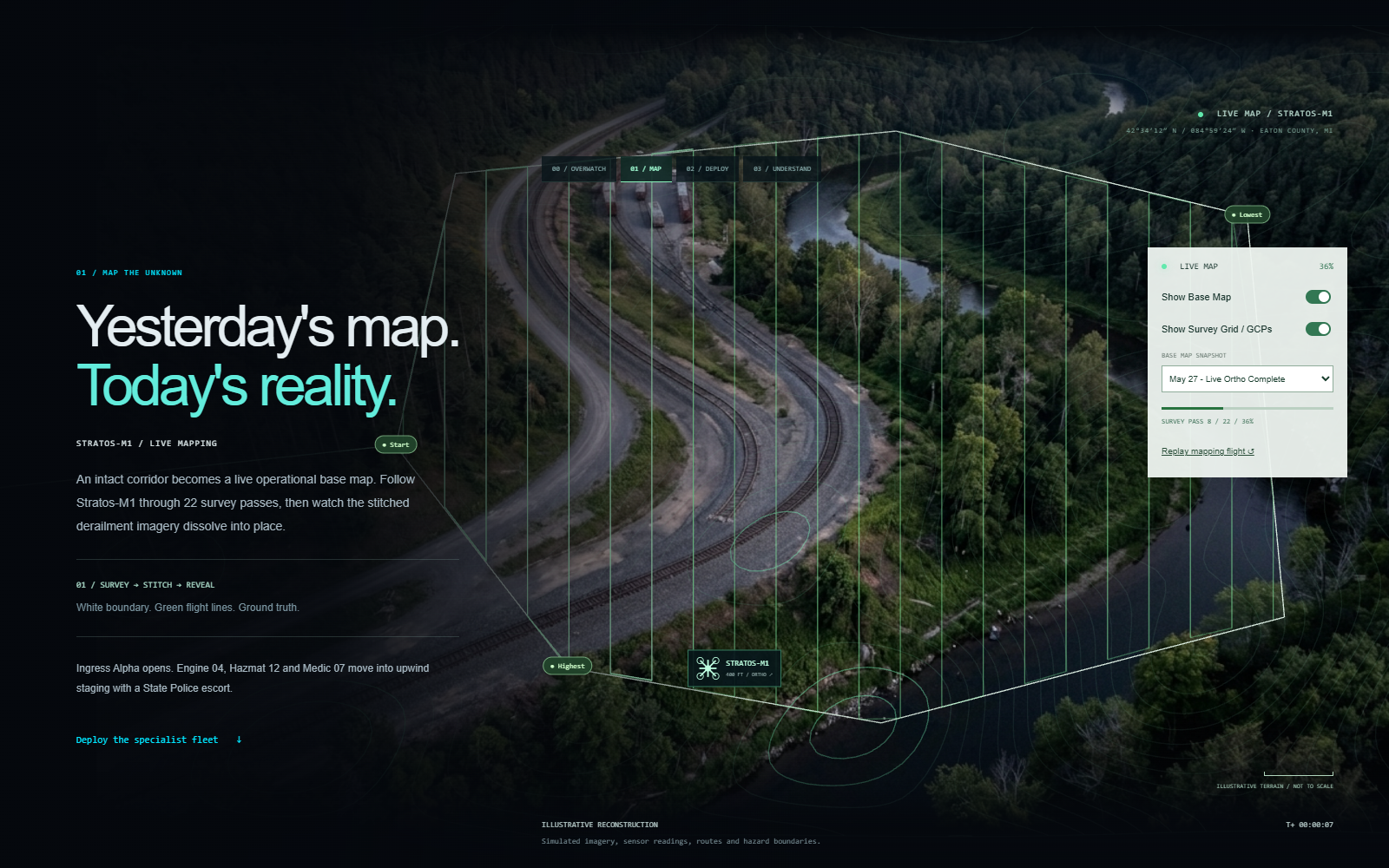
01 Map the Unknown - Aeris Overwatch Systems
01 / MAP THE UNKNOWN

Yesterday’s Map → Today’s Reality

Satellite tiles are months or years old. High-altitude survey passes stream live RTMP frames and dissolve just-in-time ground overlays directly into place over the stale basemap.

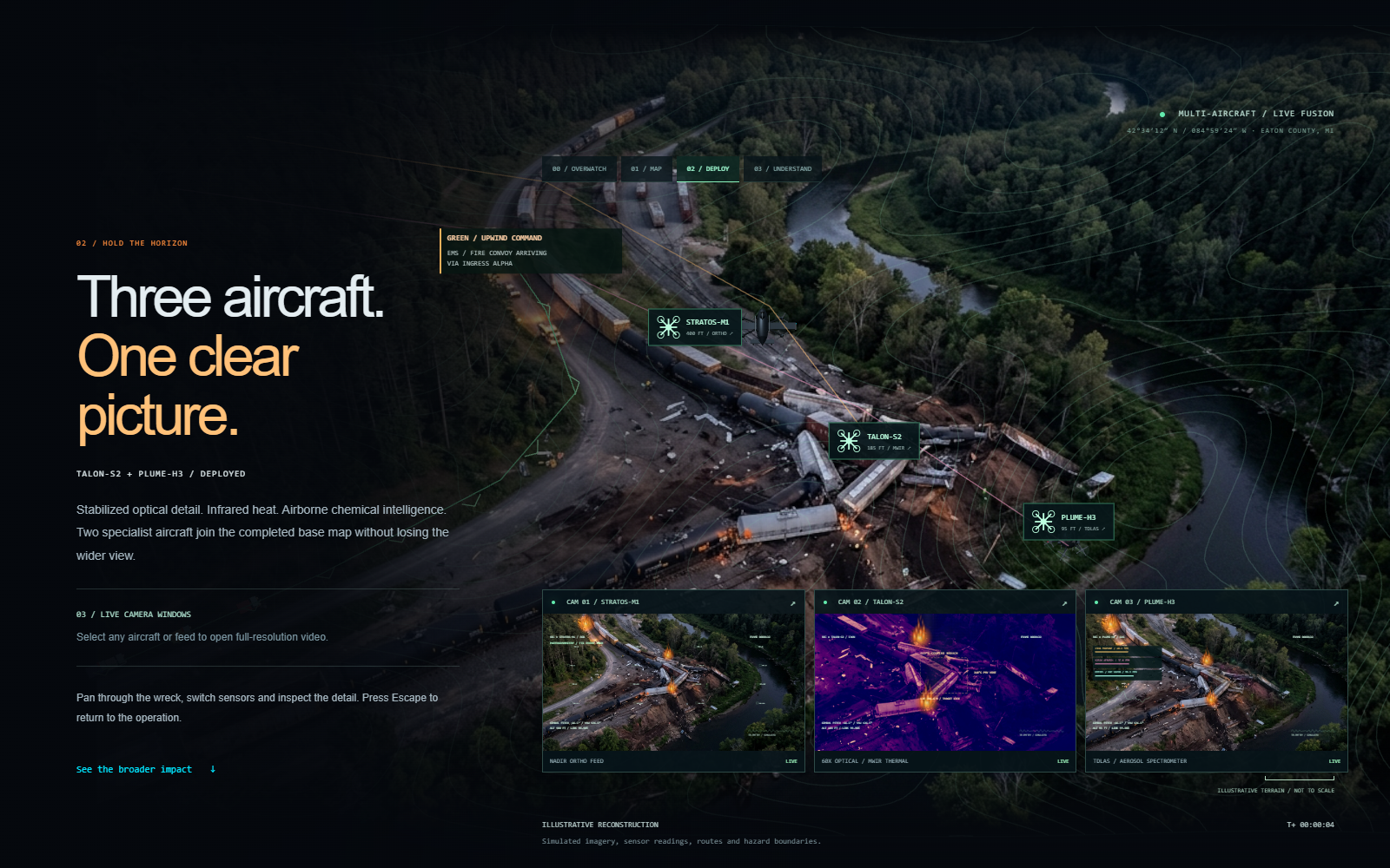
02 Hold the Horizon - Multi-Aircraft Live Feeds
02 / HOLD THE HORIZON

Cue Dedicated Live-Video Drones

Once the just-in-time orientation overlay reveals blocked lanes, damaged structures, or shoreline hazards, secondary aircraft lock onto priority sectors with continuous live video feeds.

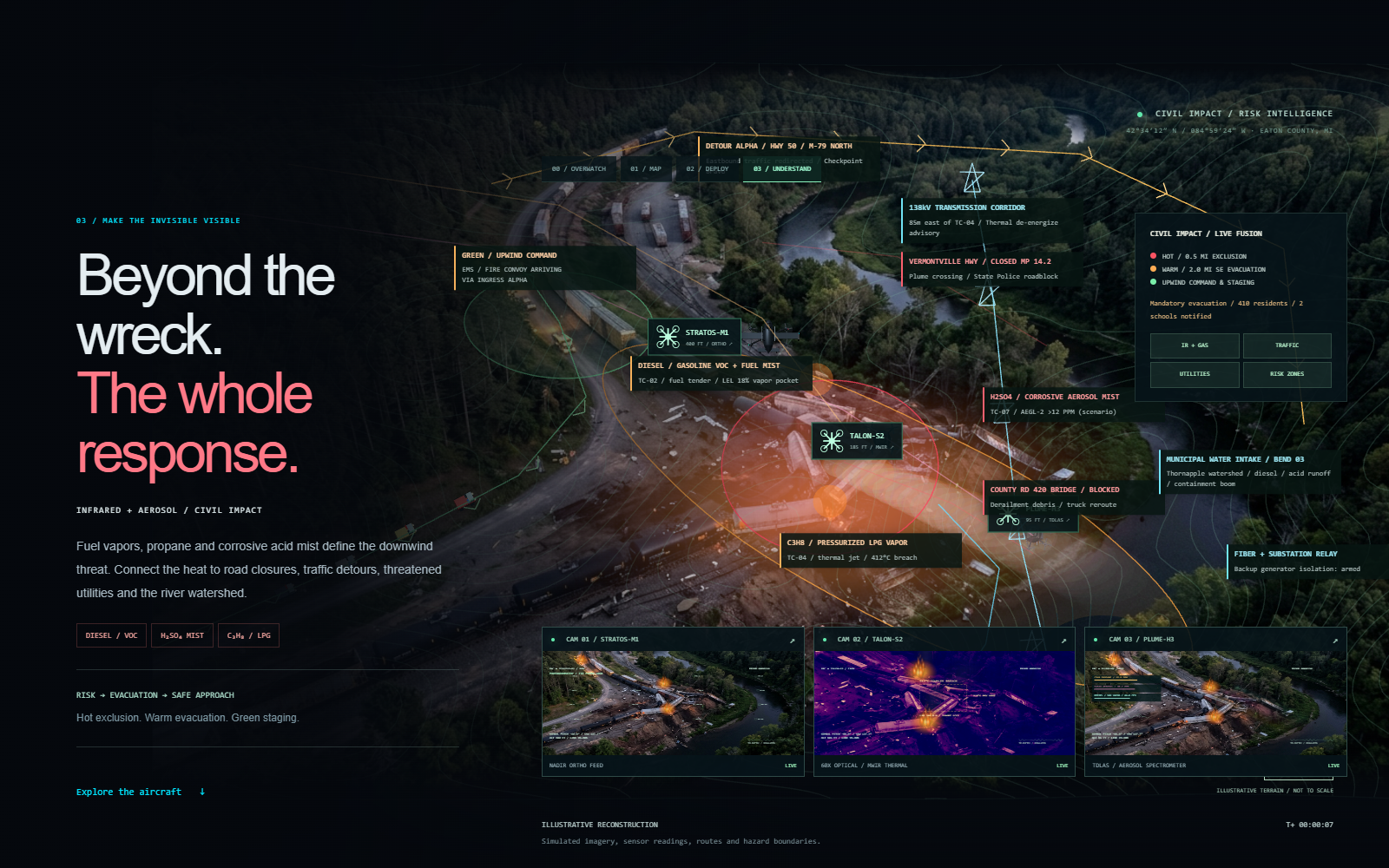
03 Make the Invisible Visible - Full Incident Response
03 / MAKE THE INVISIBLE VISIBLE

Layer Sensor & Response Overlays

With accurate just-in-time geometry underneath, commanders fuse downwind atmospheric plume envelopes, environmental sensor contours, traffic detours, and responder staging on one picture.

Bringing Imagination to Life With AI: Phase 01 on that fictitious site promised: “Watch the stitched derailment imagery dissolve into place.” Even on expensive enterprise RTK drones, aligned maps usually require landing and sending photos back for offline or cloud post-processing rather than appearing live out of the box from an RTMP video stream. Years later, AI helped me bring that concept to life as a real proof of concept on my consumer-grade Mavic 2 Pro by resolving six cascading physics & UX hurdles in software.

Act II: 6 Real Flight Clips (Cause & Effect Engineering Walkthrough)

Click each stage (or press 1–6) to watch the actual Mavic 2 flight & map-build clips pointing directly at each technical hurdle.

Stage 1: Zero-GPS RTMP Downlink & Auto WP1→WP8 Trimming

Real Mavic 2 Pro Flight Footage · Annotated Technical Walkthrough
1. Technical Challenge

2. Root Physical Cause

3. Effect on Live Map

4. Engineering Fix

Act III: Rendered 1080p LinkedIn Demonstration Video & Post Kit

Ready to upload natively to LinkedIn (1920×1080 H.264 MP4 with burned-in story captions & real Mavic 2 aerial footage).

Ready-to-Post First-Person LinkedIn Narrative

Connects OrgSonar → 1st-place Everbridge Freaky Friday & 1909 Vermontville inspiration → AI + Mavic 2 proof of concept → Progressive Focus Dissolve.